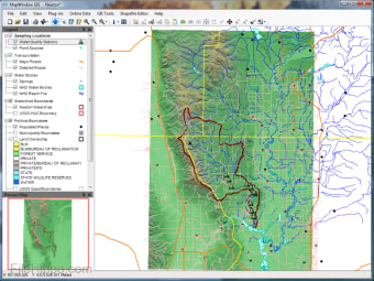
スクリーンショット
The MapWindow GIS app is a free, open source extensible geographic information system (GIS), which may be used as an open-source alternative desktop GIS, to distribute data to others, or to develop and distribute custom spatial data analysis tools.
The app includes standard GIS data visualization features as well as DBF attribute table editing, Shapefile editing, and data converters. MapWindow GIS supports dozens of standard GIS formats, including Shapefiles, GeoTIFF, ESRI ArcInfo ASCII and binary grids.
The interface is fairly standard and is not difficult to navigate. The default layout includes a map area, a legend pane and a preview-map pane. In addition there are also built-in toolbar buttons that allow you to create, save and open project files, and navigate and print the map.
The navigation tools include functions such as pan, zoom-in, zoom-out, zoom-to-selected-layer, zoom-to-selected-shapes, and zoom-to-full-extents. There is also a toolbar button for adding and removing data layers from the map, and a ‘selection’ tool as well.


